Hurricane This Weekend ?!?! Details here
nbc12 .com – ** See the latest model forecast maps below from GFS and European. They continue to show widely divergent solutions of storm track, with the Euro keeping
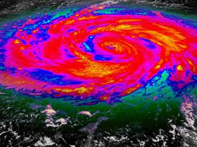
Source: Eyeidea / Getty
on heading towards Bermuda, NOT the U.S., while GFS and most other models bring it directly into the Carolinas. The model maps below are for 8am Sunday. There should be more clarity with tonight’s model runs after hurricane hunter data is assimilated into the computer database.
Joaquin has strengthened, with more expected– it’s a favorable spot for intensification. Low wind shear and warm water mean in the next day or two it could jump to a Cat. 2 (3 is not out of the question).
The uncertainty of storm track keeps the forecast in flux for now. Regardless, there’s near 100% chance of heavy rain Friday and Saturday, with 4-6″ possible. Flash flooding is likely as deep tropical moisture gets caught up in a stationary front along the coast. This is BEFORE Joaquin works its way up the coast. Rain will be accompanied by a strong NE Winds, which will kick up surf/tides to dangerous levels.
Then, it’s on to Joaquin is potentially HIGH-IMPACT storm as it could merge with a developing Nor’easter, bringing catastrophic conditions to VA and NC, especially along the coast. Again, the caveat on this is if the Euro model is correct, then conditions NOT as bad.
This is the latest forecast track from NHC:
This track is subject to change with newer data late tonight, ESPECIALLY on the Sunday/Monday time frame.
Now check out this: It’s a compilation of many of the US models on Joaquin– and there’s a strong consensus toward a VA. Beach or North Carolina landfall.
This track would be CATASTROPHIC and cause major damage across the state. Power outages, trees down, flooding rain: All are on the table.
Waves, Coastal Flooding, Coastal Erosion are looking likely. Water piling up in the bay could bring another round of coastal flooding on our tidal rivers. This flooding could be worse than the round of flooding we had last weekend!
This map is from NOAA’s weather prediction center. It forecasts 5-9″ of rain for most of the state. This would include 2 heavy batches. One on Friday, and the next on Sunday as Joaquin arrives. This amount of rain will likely bring flooding on all rivers/creeks/streams. If this happens, we’ll be testing the flood walls in Richmond.
I don’t know man. Last time they told me everything was gonna be okay.. I didnt have power all weekend…
READ MORE HERE http://blogs.nbc12.com/weather/2015/09/6-ways-tropical-storm-joaquin-could-impact-virginia.html


